GENERAL SITUATION: Residual Saharan dust and high pressure ridging are maintaining warm, dry conditions across the Turks and Caicos Islands today.
SPECIAL WARNINGS: A Dust Advisory remains in effect for the Turks & Caicos Islands until 8 pm this evening. Residents, especially those with respiratory conditions, should take the necessary precautions to safeguard their health.
UV Index: The public are advised to wear protective clothing and sunscreen, and seek shaded areas while outside during peak sunshine hours (11am – 4pm), as UV indices are expected to be in the very high to extreme range.
ALL AREAS
WEATHER: Partly sunny and hazy today. Mostly fair tonight.
WINDS: East to southeast at 10 to 20 knots
SEAS: Smooth to slight with wave heights of 3 feet or less nearshore, building up to 4 feet offshore
DAYTIME HIGH TEMPERATURE 91°F 33°C
HEAT INDEX 102°F 39°C
OVERNIGHT LOW TEMPERATURE 81°F 27°C
SUNSET: 07:34 PM
NEXT LOW TIDE: 05:31 PM (0.7 FT)
NEXT HIGH TIDE: 11:49 PM (2.6 FT)
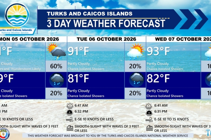
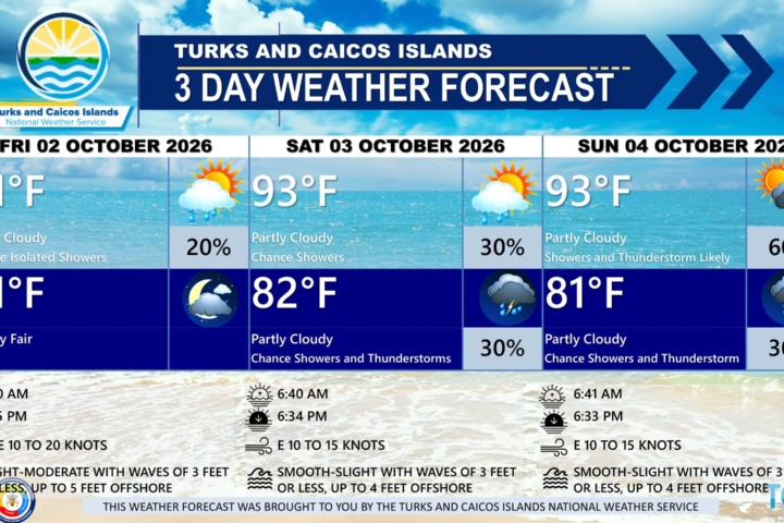
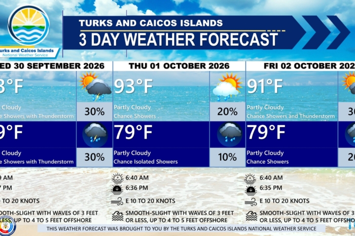
EXTENDED FORECAST: Saharan dust levels are expected to gradually clear by Saturday. Over the weekend and into early next week, increasing moisture and a developing trough will raise the chance of showers activity across the Turks and Caicos Islands. Another plume of Saharan dust is then expected to move into the region by mid-next week as high pressure builds, limiting shower activity once again.
SATURDAY: Isolated showers possible. Partly sunny, with a high near 92°F (34°C).
SATURDAY NIGHT: Mostly fair, with a low around 81°F (27°C).
WINDS: East to southeast at 10 to 20 knots
SEAS: Smooth to slight with wave heights of 3 feet or less nearshore, building up to 5 feet offshore
SUNRISE: 06:15 AM
SUNSET: 07:34 PM
LOW TIDE: 06:11 AM (0.7 FT) 06:29 PM (0.7 FT)
HIGH TIDE: 12:14 PM (2.6 FT) ——
SUNDAY: Partly sunny, with a high near 91°F (33°C).
SUNDAY NIGHT: Isolated showers possible. Mostly fair, with a low around 81°F (27°C).
WINDS: East to southeast at 10 to 20 knots
SEAS: Smooth to slight with wave heights of 3 feet or less nearshore, building up to 5 feet offshore
SUNRISE: 06:16 AM
SUNSET: 07:33 PM
HIGH TIDE: 12:39 AM (2.6 FT) 01:11 PM (2.6 FT)
LOW TIDE: 06:58 AM (0.7 FT) 07:30 PM (1.0 FT)
TROPICAL WEATHER OUTLOOK:
1. Eastern Tropical Atlantic: A broad area of low pressure, associated with a tropical wave and located a couple of hundred miles southeast of the Cabo Verde Islands has a low chance of tropical cyclone formation within 48 hours, and through the next seven (7) days, as the system continues west-northwestward. Significant development of this system is not expected before environmental conditions become even less favorable for development over the weekend.
2. Northeastern Gulf of Mexico and Offshore of the Southeastern US: An area of low pressure is forecast to form this weekend over the Northeastern Gulf of America has a low chance of tropical cyclone formation within the next seven (7) days, as the system moves northeastward.
FORECASTER: H. HAMILTON