
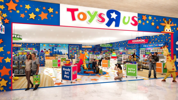
Toys R Us Making A Comeback
Toys “R” Us is planning a major expansion of its physical retail presence in the United States, with 120 new standalone stores expected to open in time for the 2026 holiday shopping season.
The expansion, being carried out through a partnership between brand owner WHP Global and Go! Retail Group, is expected to increase the company’s U.S. standalone footprint from about 40 locations to 160.
The move marks another significant step in the revival of the once-dominant toy retailer, nearly a decade after Toys “R” Us filed for bankruptcy in 2017 and subsequently closed its large warehouse-style stores across the United States.
The latest version of Toys “R” Us, however, will look considerably different from the sprawling big-box stores remembered by generations of shoppers.
Many of the new locations are expected to operate in smaller, more compact spaces, with some measuring around 5,000 square feet. The company is also placing greater emphasis on interactive shopping experiences aimed at attracting children, parents, teenagers and adult collectors.
Select stores are expected to feature experiential elements including cafés, candy shops and creator studios where social media events, product demonstrations and launches can be held.
The new Toys “R” Us stores are expected to carry traditional children’s toys alongside merchandise from major brands and franchises including LEGO, Pokémon, Barbie and Hot Wheels.
The standalone expansion builds on the company’s existing retail strategy in the United States, which includes Toys “R” Us shop-in-shop locations inside Macy’s department stores.
The brand has also experimented with stores in airports and other non-traditional locations as it seeks to reach consumers in places beyond conventional shopping malls.
Toys “R” Us was once one of the most recognizable toy retailers in the United States, with hundreds of stores before financial difficulties led to its bankruptcy and the closure of its domestic locations.
Under WHP Global, the brand has gradually returned to physical retail, although with smaller stores and a greater focus on experiences and changing consumer shopping habits.
The planned addition of 120 standalone stores represents one of the company’s largest U.S. retail expansions since its collapse and signals a renewed effort to make Toys “R” Us a significant destination for American toy shoppers.

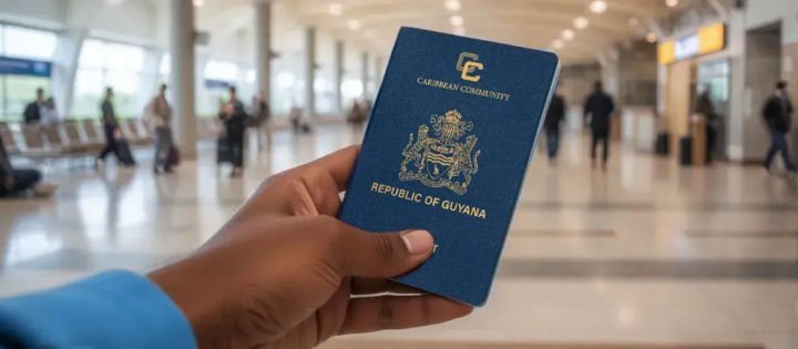
Guyana Issues Over 55,000 E-Passports in First Half of 2026
More than 55,000 electronic passports were issued in Guyana during the first six months of 2026, as the government continues efforts to modernize immigration, identification and public services.
According to Guyana’s 2026 Mid-Year Report, the e-passports were issued between January and June as part of ongoing upgrades to the country’s identity and border-management systems.
The government is also expanding access to passport services, particularly for residents living outside Georgetown.
As part of that effort, an online passport application and appointment system was launched in June, allowing applicants to begin and manage portions of the process digitally. The report said more than 500 people had used the online platform following its launch.
Further expansion is planned before the end of 2026, with additional passport services expected to become available through Integrated Government Service Centres. The move is intended to reduce the need for residents in outlying communities to travel to Georgetown to access passport-related services.
The improvements are being introduced alongside the continued rollout of Guyana’s national electronic identification system.
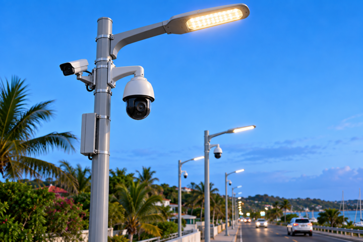
Government of Antigua and Barbuda to Bring in New Streetlights and Cameras
The Government of Antigua and Barbuda is preparing to import container loads of smart streetlights equipped with built-in security cameras as part of a wider push to improve public safety, modernize infrastructure and enhance communities across the country.
Prime Minister Gaston Browne announced the initiative during the Browne and Browne Show on Saturday, October 3, 2026.
According to Browne, the advanced streetlights are expected to be installed primarily along major public roads. In addition to providing improved lighting, the units will feature integrated security cameras capable of being operated remotely and transmitting live images directly to mobile devices.
The initiative is expected to support several government priorities, including crime prevention, monitoring traffic violations, discouraging illegal dumping and littering, and improving the overall appearance of communities.
The smart streetlight project will complement a broader national surveillance initiative that involves the deployment of approximately 200 cameras at strategic locations across Antigua and Barbuda.
Prime Minister Browne said Cabinet members have been asked to finalize the details of the smart streetlight initiative, with the government hoping to move ahead with the importation in the near future.

TCI's Junior Minister of Tourism is Heading to Guyana
TCI's Junior Minister of Tourism is heading to Guyana for the State of the Industry Tourism Conference featuring the Regional Youth Congress.
Our Danae Dennie has more.
TCI Deputy Governor's Annual 5K Run/Walk Raises Over $100,000 for 3 Charities
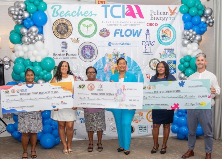
On September 29, 2026, Deputy Governor and Head of the Public Service Her Excellency Anya Williams hosted the official cheque handover ceremony for the 2nd Annual Deputy Governor's 5K Run/Walk for a Cause in the Messel Ballroom at The Palms Resort.
The ceremony presented a grand total of $108,799 raised from the successful island-wide event held on June 6, 2026, across three key non-profit organizations, with $46,980 awarded to the National Cancer Society of the TCI, $34,434 to Ashley’s Learning Centre and $27,385 to United Way Turks and Caicos.
Deputy Governor Anya Williams spoke about where this idea generated from.
The Deputy Governor went on to say that this event is a community event...
And we heard from the recipient's of the funds... starting with Claudine Ewing of United Way TCI.
Then... Lucille Campbell of the National Cancer Society.
And last but not least Ben Avenant of Ashley's Learning Centre.
The Office of the Deputy Governor extends its deepest gratitude to all corporate partners, generous sponsors, civil servants, volunteers and emergency services personnel whose unwavering dedication, financial backing and hands-on support made the 2nd Annual Deputy Governor's 5K Run/Walk an extraordinary success for the entire Turks and Caicos Islands community.
AUDIO VERSION BELOW:
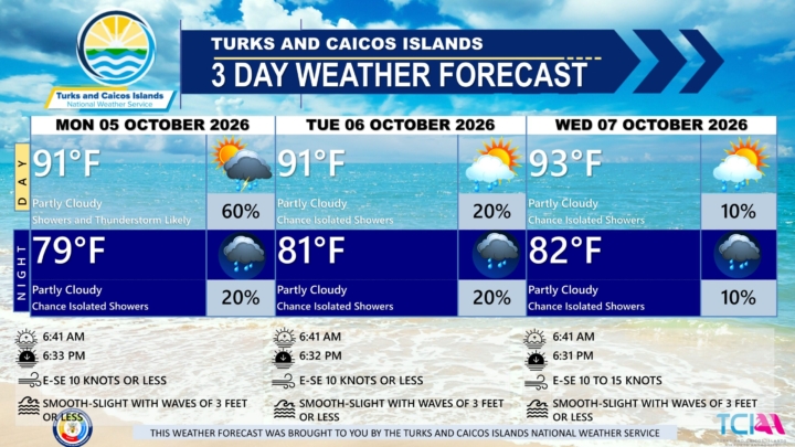
3 DAY PUBLIC WEATHER FORECAST FROM MONDAY OCTOBER 5TH 2026
PUBLIC FORECAST FOR THE TCI FOR THE NEXT THREE DAYS FROM MONDAY 05TH OCTOBER 2026
GENERAL SITUATION: A weak high pressure is maintaining gentle to moderate breezes and smooth to slight seas, while an upper-level disturbance is generating showers and thunderstorms across the Turks and Caicos Islands today.
SPECIAL WARNINGS: There are currently no public warnings in effect at this time.
ALL AREAS
WEATHER: Partly cloudy to cloudy with a medium (40 to 60 percent) chance of scattered showers and isolated thunderstorms this afternoon. Partly cloudy with a low (10 to 20 percent) chance of isolated showers tonight.
WINDS: East to southeast at 10 knots or less
SEAS: Smooth to slight with wave heights of 3 feet or less
DAYTIME HIGH TEMPERATURE 91°F 33°C
HEAT INDEX 100°F 38°C
OVERNIGHT LOW TEMPERATURE 79°F 26°C
SUNSET: 06:33 PM
NEXT HIGH TIDE: 04:47 PM (3.0 FT)
NEXT LOW TIDE: 11:23 PM (1.0 FT)
EXTENDED FORECAST: The upper-level disturbance will drift away from the area, bringing a gradual reduction in shower and thunderstorm activity by midweek. However, a tropical wave passing south of the islands is expected to briefly increase shower chances by the end of week.
TUESDAY: Partly cloudy with a low (10 to 20 percent) chance of isolated showers. Highs near 91°F (33°C).
TUESDAY NIGHT: Partly cloudy with a low (10 to 20 percent) chance of isolated showers. Lows around 81°F (27°C).
WINDS: East to southeast at 10 knots or less
SEAS: Smooth to slight with wave heights of 3 feet or less
SUNRISE: 06:41 AM
SUNSET: 06:32 PM
HIGH TIDE: 05:02 AM (2.3 FT) 05:46 PM (3.0 FT)
LOW TIDE: 1:13 AM (0.7 FT) - - - - -
WEDNESDAY: Partly cloudy with a low (10 percent) chance of isolated showers. Highs near 93°F (34°C).
WEDNESDAY NIGHT: Partly cloudy with a low (10 percent) chance of isolated showers. Lows around 82°F (28°C).
WINDS: East to southeast at 5 to 15 knots
SEAS: Smooth to slight with wave heights of 3 feet or less
SUNRISE: 06:41 AM
SUNSET: 06:31 PM
LOW TIDE: 12:17 AM (0.7 FT) 12:20 PM (0.7 FT)
HIGH TIDE: 06:07 AM (2.3 FT) 06:40 PM (2.6 FT)
TROPICAL WEATHER OUTLOOK:
1. Southwestern Gulf of America: A trough of low pressure in the southwestern Gulf of America is producing disorganized showers and thunderstorms. Gradual development is becoming more likely, and a tropical depression is likely to form during the middle or latter portion of the week. This system is expected to drift eastward over the next few days, before it turns northward. This system has a high chance of formation during the next 7 days.
FORECAST: H. HAMILTON
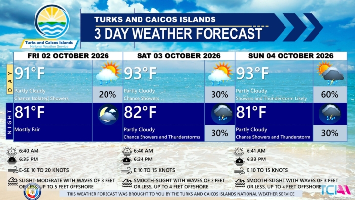
3 DAY PUBLIC WEATHER FORECAST FROM FRIDAY OCTOBER 2ND 2026
PUBLIC FORECAST FOR THE TCI FOR THE NEXT THREE DAYS FROM FRIDAY 02ND OCTOBER 2026
GENERAL SITUATION: A high pressure ridge is maintaining generally stable conditions across the Turks and Caicos Islands today, with the chance of an odd passing shower.
SPECIAL WARNINGS: There are currently no public warnings in effect at this time.
ALL AREAS
WEATHER: Partly cloudy with a low (10 to 20 percent) chance of isolated showers. Mostly fair tonight. New rainfall accumulation of a tenth of an inch.
WINDS: East to southeast at 10 to 20 knots
SEAS: Slight to moderate with wave heights 3 feet or less, building up to 5 feet offshore
DAYTIME HIGH TEMPERATURE 91°F 33°C
HEAT INDEX 104°F 40°C
OVERNIGHT LOW TEMPERATURE 81°F 27°C
SUNSET: 06:35 PM
NEXT HIGH TIDE: 01:38 PM (3.0 FT)
NEXT LOW TIDE: 08:12 PM (1.0 FT)
EXTENDED FORECAST: Generally favorable weather will continue across the Turks and Caicos Islands through the weekend. However, an upper-level disturbance is expected to move across the islands on Sunday, increasing the chance of showers and thunderstorms. The disturbance will move away by Monday evening, with weak high pressure maintaining mostly settled conditions into the work week.
SATURDAY: Partly cloudy with a low (10 to 30 percent) chance of showers. Highs near 93°F (34°C).
SATURDAY NIGHT: Partly cloudy with a low (10 to 30 percent) chance of showers with isolated thunderstorm possible. Lows around 82°F (28°C). New rainfall accumulation of about a tenth of an inch.
WINDS: Easterly at 10 to 15 knots
SEAS: Smooth to slight with wave heights 3 feet or less, building up to 4 feet offshore
SUNRISE: 06:40 AM
SUNSET: 06:34 PM
HIGH TIDE: 01:38 AM (2.0 FT) 02:40 PM (3.0 FT)
LOW TIDE: 07:51 AM (0.3 FT) 09:17 PM (1.0 FT)
SUNDAY: Partly cloudy with a medium (40 to 60 percent) chance of showers with isolated thunderstorms. Highs near 93°F (34°C).
SUNDAY NIGHT: Partly cloudy with a low (10 to 30 percent) chance of showers with isolated thunderstorms. Lows around 81°F (27°C). New rainfall accumulation between a tenth and a quarter of an inch.
WINDS: Easterly at 10 to 15 knots
SEAS: Smooth to slight with wave heights 3 feet or less, building up to 4 feet offshore
SUNRISE: 06:41 AM
SUNSET: 06:33 PM
HIGH TIDE: 02:42 AM (2.0 FT) 03:44 PM (3.0 FT)
LOW TIDE: 08:55 AM (0.7 FT) 10:22 PM (1.0 FT)
TROPICAL WEATHER OUTLOOK:
A trough of low pressure associated with the remnants of former Tropical Storm Fay is located several hundred miles south-southeast of Bermuda. Despite ongoing thunderstorm activity, dry air and strong upper-level winds are expected to prevent significant re-development while it moves north-northwestward at 5 to 10 mph to the east of Bermuda. This system has a low chance of formation during the next 7 days.
FORECASTER: H. HAMILTON
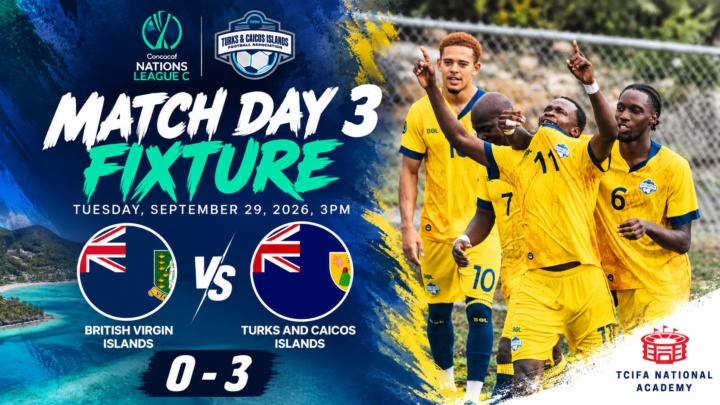
TCI Defeats BVI In CONCACAF Match Fixture
The Turks and Caicos Islands delivered a commanding performance on Tuesday, September 29th at the TCIFA pitch in Providenciales, securing a 3-0 victory over the British Virgin Islands in Concacaf Nations League C action.
Billy Forbes led the way, while Junior Paul also found the net as TCI claimed an emphatic victory.
Forbes wasted little time putting his side in control, opening the scoring in the 10th minute. The early breakthrough gave the Turks and Caicos Islands the advantage they were looking for, and they carried the 1-0 lead into halftime.
TCI continued to apply pressure after the restart and doubled their advantage in the 52nd minute, when Junior Paul struck to make it 2-0.
Forbes then returned to finish the job in the 74th minute, scoring his second goal of the contest and stretching the lead to 3-0.
There was no way back for the British Virgin Islands as the Turks and Caicos Islands protected their clean sheet through the final whistle to complete an impressive three-goal victory.
Forbes’ two-goal performance proved decisive, with the experienced attacker striking once in each half, while Paul’s second-half contribution helped put the match firmly beyond BVI’s reach.
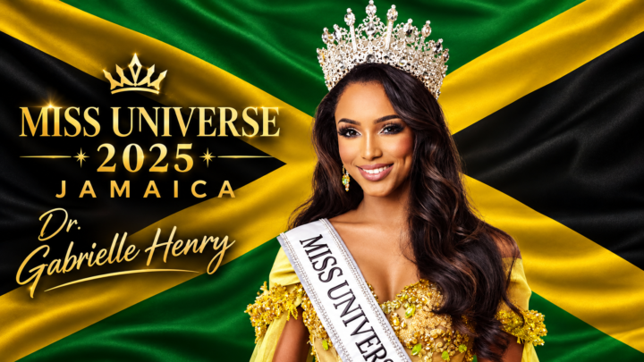
Former Miss Universe Jamaica Sues Miss Universe Organization
Former Miss Universe Jamaica Dr. Gabrielle Henry has filed a lawsuit against the Miss Universe Organization and two of its parent companies over injuries she sustained after falling from the stage during the 2025 Miss Universe competition in Thailand.
The lawsuit, filed Sept. 21 in Delaware Superior Court, names the Miss Universe Organization, JKN Legacy Inc. and Legacy Holding Group USA as defendants. It includes claims of negligence, premises liability and emotional distress.
Henry fell about five feet during the preliminary competition on Nov. 19, 2025. Her complaint alleges she fell through an “unmarked and uncovered opening” in the stage while following rehearsed choreography and that bright lighting impaired her visibility.
She alleges she lost consciousness and suffered a traumatic brain injury, including brain haemorrhages, requiring hospitalisation until Dec. 10.
Henry, an ophthalmologist, claims the injuries prevented her from returning to her medical residency and that she continues to experience neurological and cognitive symptoms.
The lawsuit seeks damages for medical expenses, emotional distress, lost earning capacity and professional opportunities.
Henry also alleges contestants had raised concerns about the staging and lighting before her fall and that changes were made to the stage afterward.
The Miss Universe Organization has disputed responsibility, saying it had not been served with the lawsuit and that Miss Grand International (MGI) and Miss Universe Thailand were responsible for the venue, stage and on-site safety.
The organisation said it covered Henry’s hospital expenses and subsequent treatment in Jamaica, along with accommodation, transportation and other costs.
MGI has also disputed claims that stage conditions caused the accident, previously saying Henry missed her blocking and may not have been looking at the runway.
Henry returned to Jamaica on Dec. 20, 2025.
The lawsuit will now put the competing accounts of the accident and responsibility for Henry’s injuries before the court.
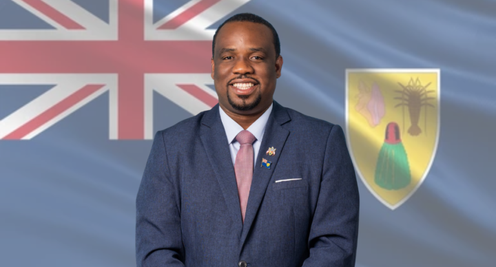
Samajeo Williams Appointed as Director of the National Public Health Laboratory
The Office of the Deputy Governor has announced the appointment of Samajeo Williams as Director of the National Public Health Laboratory within the Ministry of Health and Human Services.
Williams returns to the position after previously serving as director from February 2021 to June 2023, when he helped lead national laboratory services through the COVID-19 pandemic.
During his previous tenure, Williams expanded local molecular diagnostic testing capabilities and helped strengthen public health laboratory infrastructure across the Turks and Caicos Islands. He also served as a certified trainer for the TCI Government from 2022 to 2023 and held an IATA Infectious Substances Transport Trainer Certification.
Williams holds degrees in Biology and Psychology from Newcastle University...He is also an accredited Specialist Biomedical Scientist in Microbiology.
He recently completed a Master of Science in Clinical Science (Infection Sciences) at Queen Mary University of London, graduating with Distinction in 2026.
Williams also completed specialist training in Clinical Microbiology with the Bolton NHS Foundation Trust in the United Kingdom from 2023 to 2026.
The Office of the Deputy Governor congratulated Williams on his appointment and welcomed his return to public service in the Turks and Caicos Islands.