PUBLIC FORECAST FOR THE TURKS AND CAICOS ISLANDS FOR THE NEXT THREE DAYS
GENERAL SITUATION: High pressure is gradually building across the Turks and Caicos Islands, bringing hot and breezy conditions today.
SPECIAL WARNINGS: There are currently no warnings in effect at this time.
ALL AREAS
WEATHER: Partly cloudy with isolated showers possible through tonight.
WINDS: East to southeast at 10 to 15 knots
SEAS: Smooth to slight with wave heights of 3 feet or less, building up to 4 feet offshore
DAYTIME HIGH TEMPERATURE 91°F 33°C
HEAT INDEX 102°F 39°C
OVERNIGHT LOW TEMPERATURE 79°F 26°C
SUNSET: 07:32 PM
NEXT LOW TIDE: 11:19 AM (1.0 FT)
NEXT HIGH TIDE: 05:57 PM (2.6 FT)
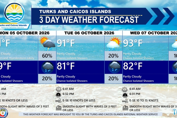
EXTENDED FORECAST: High pressure and another surge of Saharan dust will maintain generally dry and hazy conditions across the Turks and Caicos Islands through early next week. A strong tropical wave is expected to arrive late Tuesday, bringing an increasing chance of showers and thunderstorms through Thursday.
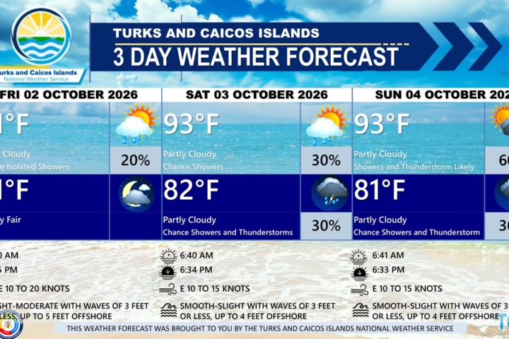
SATURDAY: Isolated showers possible. Partly cloudy and hazy, with a high near 91°F (33°C).
SATURDAY NIGHT: Mostly fair, with a low around 81°F (27°C).
WINDS: East to southeast at 10 to 15 knots
SEAS: Smooth to slight with wave heights of 3 feet or less, building up to 4 feet offshore
SUNRISE: 06:18 AM
SUNSET: 07:31 PM
LOW TIDE: 12:37 AM (1.0 FT) 12:08 PM (1.0 FT)
HIGH TIDE: 06:10 AM (2.0 FT) 06:45 PM (2.6 FT)
SUNDAY: Isolated showers possible. Partly cloudy and hazy, with a high near 91°F (33°C).
SUNDAY NIGHT: Mostly fair, with a low around 81°F (27°C).
WINDS: East to southeast at 10 to 15 knots
SEAS: Smooth to slight with wave heights of 3 feet or less, building up to 4 feet offshore
SUNRISE: 06:19 AM
SUNSET: 07:31 PM
LOW TIDE: 01:19 AM (1.0 FT) 12:53 PM (0.7 FT)
HIGH TIDE: 06:55 AM (2.0 FT) 07:29 PM (2.6 FT)
TROPICAL WEATHER OUTLOOK: Tropical cyclone formation is not expected during the next seven (7) days.
FORECASTER: H. HAMILTON