
GENERAL SITUATION: A mid-level trough interacting with abundant tropical moisture will continue to spark showers and thunderstorms across parts of the Turks and Caicos Islands today.
SPECIAL WARNINGS: None.
Rip currents: There is a moderate risk of rip currents across Atlantic-facing coastlines. Beachgoers are advised to exercise extreme caution when entering the water, particularly along Atlantic-exposed beaches.
ALL AREAS
WEATHER: Mostly cloudy to occasionally overcast with a low (10 to 30 percent) chance of showers with thunderstorms through tonight.
WINDS: Variable less than 10 knots
SEAS: Smooth to slight with wave heights of 3 feet or less in the Caicos Bank; Slight to moderate with wave heights of 2 to 4 feet, building up to 5 feet offshore.
DAYTIME HIGH TEMPERATURE 86°F 30°C
OVERNIGHT LOW TEMPERATURE 79°F 26°C
SUNSET: 05:10 PM
NEXT LOW TIDE: 04:20 PM (2.6 FT)
NEXT HIGH TIDE: 10:45 PM (0.7 FT)
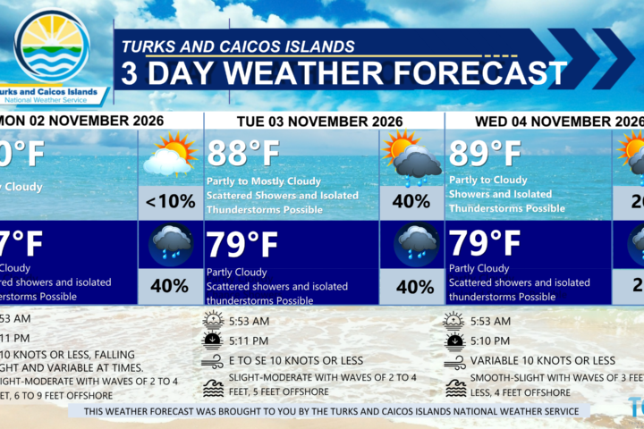
EXTENDED FORECAST: Moisture will gradually move out of the region, with drier air lowering the chance of showers by Friday. Conditions will continue to improve into the weekend.
THURSDAY: A mix of sun and clouds with a medium (40 to 60 percent) chance of showers with isolated thunderstorms. Highs near 88°F (31°C)
THURSDAY NIGHT: Partly cloudy with a low (30 percent) chance of widely scattered showers. Lows around 79°F (26°C)
WINDS: West to northwest at 10 knots or less
SEAS: Smooth to slight with wave heights of 3 feet or less in the Caicos Bank; Slight to moderate with wave heights of 2 to 4 feet, building up to 5 feet offshore.
SUNRISE: 05:54 AM
SUNSET: 05:10 PM
HIGH TIDE: 04:52 AM (2.6 FT) 05:16 PM (2.6 FT)
LOW TIDE: 11:11 AM (0.7 FT) 11:35 PM (0.7 FT)
FRIDAY: Partly cloudy with a low (10 to 20 percent) chance of isolated showers in the morning, then gradually clearing throughout the day. Highs near 89°F (32°C).
FRIDAY NIGHT: Mostly fair with isolated showers possible. Lows around 77°F (25°C).
WINDS: Northwest to north at 10 knots or less, shifting northeast in the evening
SEAS: Smooth to slight with wave heights of 3 feet or less in the Caicos Bank; Slight to moderate with wave heights of 2 to 4 feet, building up to 5 to 6 feet offshore.
SUNRISE: 05:55 AM
SUNSET: 05:09 PM
HIGH TIDE: 05:50 AM (2.6 FT) 06:09 PM (2.6 FT)
LOW TIDE: 12:13 PM (0.7 FT) – – – – –
TROPICAL WEATHER OUTLOOK:
1. Western and Central Atlantic: A broad area of low pressure is forming along a remnant frontal boundary a few hundred miles south of Bermuda. Environmental conditions could support this system gradually acquiring subtropical characteristics through this weekend while it moves slowly eastward over the western and central subtropical Atlantic. By early next week, environmental conditions are forecast to become unfavorable for further development. This system has a medium chance of formation over the next seven (7) days.
FORECASTER: H. HAMILTON
SEE AUDIO VERSION BELOW: