GENERAL SITUATION: A broad upper-level trough interacting with the remnants of a weakening frontal boundary will trigger showers and thunderstorms across portions of the Turks and Caicos Islands today.
SPECIAL WARNINGS: There are no public warnings in effect at this time.
ALL AREAS
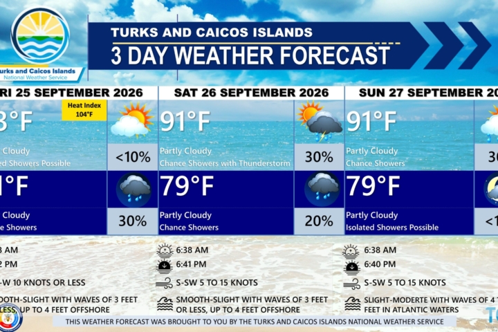
WEATHER: Partly cloudy with a low (10 percent) chance of isolated showers through tonight.
WINDS: East to southeast at 10 knots or less, increasing to 10 to 15 knots by this evening
SEAS: Smooth to slight with wave heights of 3 feet or less, building up to 4 feet offshore
DAYTIME HIGH TEMPERATURE 91°F 33°C
OVERNIGHT LOW TEMPERATURE 77°F 25°C
SUNSET: 06:39 PM
NEXT LOW TIDE: 04:32 PM (0.7 FT)
NEXT HIGH TIDE: 10:20 PM (2.3 FT)
EXTENDED FORECAST: High pressure will build across the region through the early part of the week. However, increasing moisture and an upper-level disturbance will bring a return of unsettled weather and showers across the Turks and Caicos Islands from Tuesday through much of the work week. By midweek, winds are expected to increase in strength through Friday as high pressure strengthens.
TUESDAY: Partly cloudy with a low (10 percent) chance of showers with isolated thunderstorms. Highs near 91°F (33°C)
TUESDAY NIGHT: Partly cloudy, with a low (10 to 30 percent) chance of showers. Lows around 78°F (25°C).
WINDS: Easterly at 10 to 15 knots
SEAS: Smooth to slight with wave heights of 3 feet or less, building up to 4 feet offshore
SUNRISE: 06:39 AM
SUNSET: 06:38 PM
LOW TIDE: 04:27 AM (0.3 FT) 05:23 PM (0.7 FT)
HIGH TIDE: 10:55 AM (3.0 FT) 11:04 PM (2.3 FT)
WEDNESDAY: Partly cloudy, with a low (10 to 30 percent) chance of showers with isolated thunderstorms. Highs near 91°F (33°C)
WEDNESDAY NIGHT: Partly cloudy, with a low (10 to 30 percent) chance of showers. Lows around 79°F (26°C).
WINDS: Easterly at 10 to 20 knots
SEAS: Slight to moderate with wave heights of 3 to 5 feet
SUNRISE: 06:39 AM
SUNSET: 06:37 PM
LOW TIDE: 05:12 AM (0.3 FT) 06:15 PM (1.0 FT)
HIGH TIDE: 11:46 AM (3.0 FT) 11:51 PM (2.3 FT)
TROPICAL WEATHER OUTLOOK:
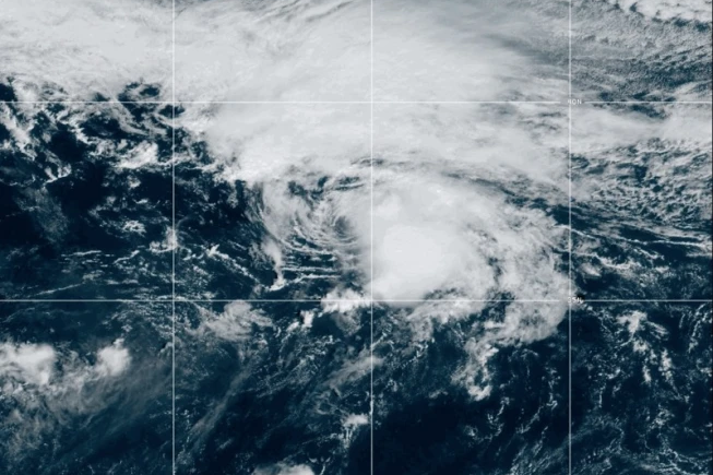
Active Systems: There are currently two active systems in the Atlantic. Tropical Depression Fay is located well to the southwest of the Azores, and newly formed Tropical Storm Hanna is located in the Central Subtropical Atlantic, about 870 miles east-northeast of Bermuda. Neither system poses a threat to the Turks and Caicos Islands. See the latest News Item issued by the Bahamas Department of Meteorology on our Facebook page for more information.
FORECASTER: H. HAMILTON