PUBLIC FORECAST FOR THE TCI FOR THE NEXT THREE DAYS FROM FRIDAY 02ND OCTOBER 2026
GENERAL SITUATION: A high pressure ridge is maintaining generally stable conditions across the Turks and Caicos Islands today, with the chance of an odd passing shower.
SPECIAL WARNINGS: There are currently no public warnings in effect at this time.
ALL AREAS
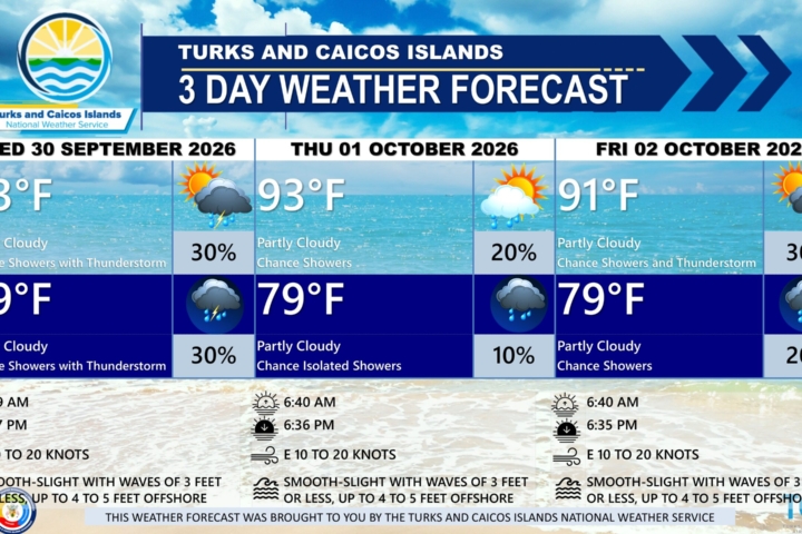
WEATHER: Partly cloudy with a low (10 to 20 percent) chance of isolated showers. Mostly fair tonight. New rainfall accumulation of a tenth of an inch.
WINDS: East to southeast at 10 to 20 knots
SEAS: Slight to moderate with wave heights 3 feet or less, building up to 5 feet offshore
DAYTIME HIGH TEMPERATURE 91°F 33°C
HEAT INDEX 104°F 40°C
OVERNIGHT LOW TEMPERATURE 81°F 27°C
SUNSET: 06:35 PM
NEXT HIGH TIDE: 01:38 PM (3.0 FT)
NEXT LOW TIDE: 08:12 PM (1.0 FT)
EXTENDED FORECAST: Generally favorable weather will continue across the Turks and Caicos Islands through the weekend. However, an upper-level disturbance is expected to move across the islands on Sunday, increasing the chance of showers and thunderstorms. The disturbance will move away by Monday evening, with weak high pressure maintaining mostly settled conditions into the work week.
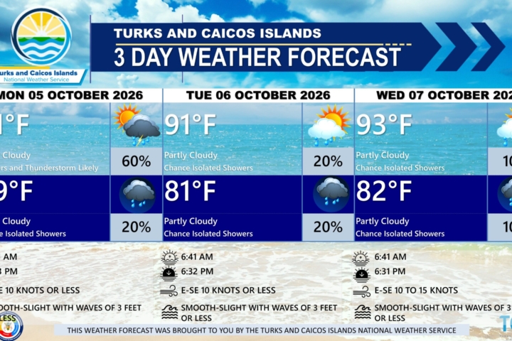
SATURDAY: Partly cloudy with a low (10 to 30 percent) chance of showers. Highs near 93°F (34°C).
SATURDAY NIGHT: Partly cloudy with a low (10 to 30 percent) chance of showers with isolated thunderstorm possible. Lows around 82°F (28°C). New rainfall accumulation of about a tenth of an inch.
WINDS: Easterly at 10 to 15 knots
SEAS: Smooth to slight with wave heights 3 feet or less, building up to 4 feet offshore
SUNRISE: 06:40 AM
SUNSET: 06:34 PM
HIGH TIDE: 01:38 AM (2.0 FT) 02:40 PM (3.0 FT)
LOW TIDE: 07:51 AM (0.3 FT) 09:17 PM (1.0 FT)
SUNDAY: Partly cloudy with a medium (40 to 60 percent) chance of showers with isolated thunderstorms. Highs near 93°F (34°C).
SUNDAY NIGHT: Partly cloudy with a low (10 to 30 percent) chance of showers with isolated thunderstorms. Lows around 81°F (27°C). New rainfall accumulation between a tenth and a quarter of an inch.
WINDS: Easterly at 10 to 15 knots
SEAS: Smooth to slight with wave heights 3 feet or less, building up to 4 feet offshore
SUNRISE: 06:41 AM
SUNSET: 06:33 PM
HIGH TIDE: 02:42 AM (2.0 FT) 03:44 PM (3.0 FT)
LOW TIDE: 08:55 AM (0.7 FT) 10:22 PM (1.0 FT)
TROPICAL WEATHER OUTLOOK:
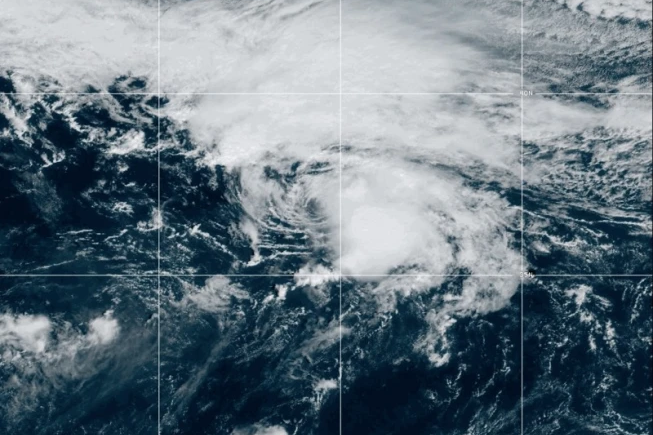
A trough of low pressure associated with the remnants of former Tropical Storm Fay is located several hundred miles south-southeast of Bermuda. Despite ongoing thunderstorm activity, dry air and strong upper-level winds are expected to prevent significant re-development while it moves north-northwestward at 5 to 10 mph to the east of Bermuda. This system has a low chance of formation during the next 7 days.
FORECASTER: H. HAMILTON