
GENERAL SITUATION: High pressure building over the western Atlantic will gradually strengthen northeast to east winds across the Turks and Caicos Islands today. The weakening frontal boundary will continue to spark showers and thunderstorms over parts of the Turks and Caicos Islands today.
SPECIAL WARNINGS: There are currently no public warnings in effect at this time.
Rip Currents: There is a high risk of rip currents along all eastern and Atlantic coastal waters as winds strengthen. Swimmers are advised to exercise caution when entering these waters and ought not to venture into waters where they cannot comfortably stand.
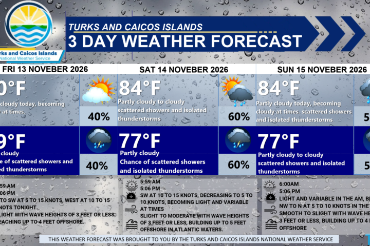
WEATHER: Partly cloudy to cloudy with a medium (60 percent) chance of scattered showers with isolated thunderstorms this afternoon, then increasing to a high (80 to 90 percent) chance of showers with thunderstorms tonight. New total rainfall accumulation between half an inch and an inch.
WINDS: Northeast to east at 10 to 15 knots, with gusts up to 25 knots
SEAS: Slight to moderate with wave heights of 2 to 4 feet, building up to 6 feet offshore
DAYTIME HIGH TEMPERATURE 86°F 31°C
OVERNIGHT LOW TEMPERATURE 77°F 25°C
SUNSET: 05:06 PM
NEXT LOW TIDE: 07:30 PM (1.3 FT) —
NEXT HIGH TIDE: 12:18 AM (2.0 FT) 01:10 PM (2.3 FT)
EXTENDED FORECAST: Brisk to strong northeast to east winds and moderate to rough seas are expected across the Turks and Caicos Islands for most of the week. A deep-layered trough developing over the Central and Southeast Bahamas on Tuesday will spread moisture and instability across the region through Thursday, increasing the chance of showers and thunderstorms. There is a marginal to slight risk of severe thunderstorms on Tuesday.
TUESDAY: Mostly cloudy to overcast with a high (80 percent) chance of showers and thunderstorms. Highs near 84°F (29°C).
TUESDAY NIGHT: Partly cloudy to cloudy with a high (70 to 80 percent) chance of showers with thunderstorms. Lows around 77°F (25°C). New total rainfall accumulation between half an inch and an inch.
WINDS: Northeast to east at 10 to 20 knots, gusting up to 30 knots
SEAS: Moderate to rough with wave heights of 4 to 6 feet, building up to 8 to 10 feet offshore
SUNRISE: 06:01 AM
SUNSET: 05:05 PM
HIGH TIDE: 01:09 AM (2.0 FT) 01:56 PM (2.3 FT)
LOW TIDE: 07:17 AM (1.0 FT) 08:15 PM (1.0 FT)
WEDNESDAY: Partly cloudy to cloudy with a high (80 percent) chance of showers with thunderstorms. Highs near 84°F (29°C).
WEDNESDAY NIGHT: Partly cloudy to cloudy with a medium (60 percent) chance of showers with thunderstorms. Lows around 77°F (25°C). New total rainfall accumulation between a quarter of an inch and a half an inch.
WINDS: Easterly at 10 to 20 knots
SEAS: Slight to moderate with wave heights of 3 to 5 feet, building up to 6 to 7 feet offshore
SUNRISE: 06:02 AM
SUNSET: 05:05 PM
HIGH TIDE: 02:09 AM (2.0 FT) 02:46 PM (2.3 FT)
LOW TIDE: 08:18 AM (1.0 FT) 09:04 PM (1.0 FT)
TROPICAL WEATHER OUTLOOK: Tropical cyclone activity is not expected during the next 7 days.
FORECASTER: H. HAMILTON
AUDIO VERSION BELOW: