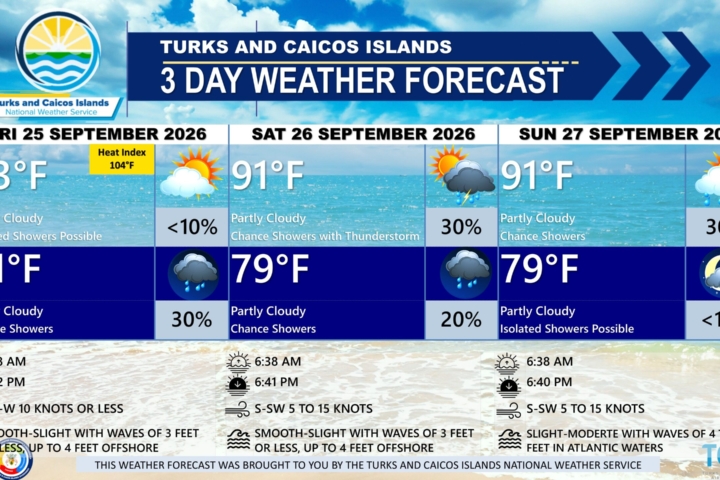
PUBLIC FORECAST FOR THE TURKS AND CAICOS ISLANDS FOR THE NEXT 3 DAYS FROM FRIDAY 18TH SEPTEMBER 2026
GENERAL SITUATION: A tropical wave and deep layered troughing continue to feed abundant moisture into the Turks and Caicos Islands today, keeping showers and thunderstorms possible at times. Light to gentle winds and smooth seas are expected across all areas.
SPECIAL WARNINGS: There are no public warnings in effect at this time.
Flooding: There is a slight risk of flooding in low-lying and flood-prone areas, with ponding on roads during heavy and prolonged rainfall events.
ALL AREAS
WEATHER: Partly cloudy with a low (10 to 20 percent) chance of showers with isolated thunderstorms this afternoon, then a medium (40 percent) chance of scattered showers and isolated thunderstorms tonight. New rainfall amounts between a tenth and quarter of an inch, except higher amounts possible in thunderstorms.
WINDS: East to southeast at 5 to 15 knots
SEAS: Smooth to slight with wave heights of 3 feet or less, building up to 4 to 5 feet offshore
DAYTIME HIGH TEMPERATURE 93°F 34°C
HEAT INDEX 104°F 39°C
OVERNIGHT LOW TEMPERATURE 80°F 26°C
SUNSET: 06:49 PM
NEXT HIGH TIDE: 02:57 PM (2.6 FT)
NEXT LOW TIDE: 09:34 PM (1.3 FT)
EXTENDED FORECAST: Abundant tropical moisture and upper level forcing will maintain periods of showers and thunderstorms activity across the country over the weekend into early next week.
SATURDAY: A low (20 to 30 percent) chance of showers with isolated thunderstorms. Partly cloudy, with a high near 93°F (34°C).
SATURDAY NIGHT: A low (10 to 20 percent) chance of showers with isolated thunderstorms. Partly cloudy, with a low around 81°F (27°C). New rainfall amounts of about a tenth of an inch.
WINDS: Southeasterly at 5 to 15 knots, falling light and variable at times
SEAS: Smooth to slight with wave heights of 3 feet or less, building up to 4 feet offshore
SUNRISE: 06:36 AM
SUNSET: 06:48 PM
HIGH TIDE: 02:54 AM (2.0 FT) 03:50 PM (2.6 FT)
LOW TIDE: 08:54 AM (1.0 FT) 10:27 PM (1.3 FT)
SUNDAY: A low (20 percent) chance of showers with isolated thunderstorms possible in the morning, then a medium (40 to 50 percent) chance of showers and isolated thunderstorms in the afternoon. Partly cloudy to cloudy, with a high near 91°F (33°C). There is a marginal to slight risk of severe thunderstorms.
SUNDAY NIGHT: A low (20 to 30 percent) chance of showers with isolated thunderstorms. Partly cloudy, with a low around 79°F (26°C). New rainfall amounts between a quarter and half of an inch, except higher amounts possible in thunderstorms.
WINDS: East to southeast at 10 knots or less
SEAS: Smooth to slight with wave heights of 3 feet or less
SUNRISE: 06:37 AM
SUNSET: 06:47 PM
HIGH TIDE: 03:46 AM (2.0 FT) 04:41 PM (2.6 FT)
LOW TIDE 09:45 AM (1.0 FT) 11:16 PM (1.3 FT)
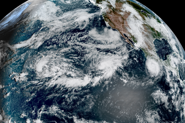
TROPICAL WEATHER OUTLOOK:
1.Eastern Subtropical Atlantic: A trough of low pressure located several hundred miles southwest of the Azores is producing showers and thunderstorms that are showing some signs of organization. This system has a low chance of formation over the next 7 days.
FORECASTER: H. HAMILTON
AUDIO VERSION BELOW: