GENERAL SITUATION: Weak high pressure is maintaining light to gentle winds across the Turks and Caicos Islands today, with a few isolated passing showers possible.
SPECIAL WARNINGS: There are currently no warnings in effect at this time.
ALL AREAS
WEATHER: Partly cloudy with a low (10 percent) chance of isolated showers today. Mostly fair tonight.
WINDS: Southeasterly at 10 knots or less, increasing to 10 to 15 knots tonight.
SEAS: Smooth to slight with wave heights of 3 feet or less
DAYTIME HIGH TEMPERATURE 93°F 34°C
HEAT INDEX 104°F 40°C
OVERNIGHT LOW TEMPERATURE 82°F 28°C
SUNSET: 06:31 PM
NEXT LOW TIDE: 12:20 PM (0.7 FT)
NEXT HIGH TIDE: 06:40 PM (2.6 FT)
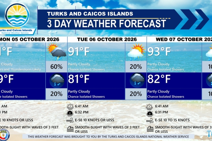
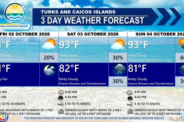
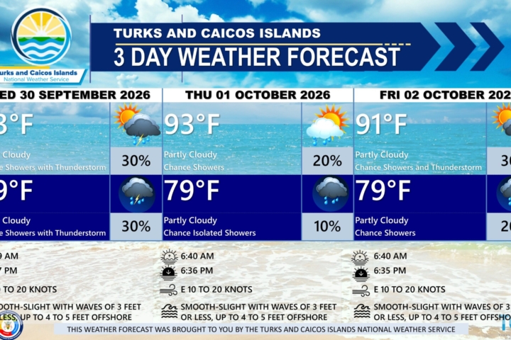
EXTENDED FORECAST: A tropical wave is expected to pass south of the Turks and Caicos Islands tomorrow, potentially triggering showers across parts of the islands and surrounding waters. Shower chances will gradually decrease heading into the weekend as high pressure builds across the region, bringing breezy conditions.
THURSDAY: Partly cloudy with a medium (40 percent) chance of showers in the morning, then a low (10 percent) chance of isolated showers in the afternoon. Highs near 93°F (34°C).
THURSDAY NIGHT: Partly cloudy with a low (30 percent) chance of showers. Lows around 80°F (27°C).
WINDS: East to southeast at 10 to 15 knots
SEAS: Smooth to slight with wave heights of 3 feet or less, building up to 4 feet offshore
SUNRISE: 06:42 AM
SUNSET: 06:30 PM
LOW TIDE: 01:06 AM (0.7 FT) 01:22 PM (0.7 FT)
HIGH TIDE: 07:07 AM (2.6 FT) 07:32 PM (2.6 FT)
FRIDAY: Partly cloudy with a medium (60 percent) chance of showers in the morning, then a low (20 percent) chance of isolated showers in the afternoon. Highs near 91°F (33°C).
FRIDAY NIGHT: Partly cloudy with a low (10 percent) chance of showers. Lows around 80°F (27°C).
WINDS: East to southeast at 10 to 20 knots
SEAS: Slight to moderate with wave heights of 2 to 4 feet
SUNRISE: 06:42 AM
SUNSET: 06:29 PM
LOW TIDE: 01:51 AM (0.7 FT) 02:19 PM (0.7 FT)
HIGH TIDE: 08:01 AM (2.6 FT) 08:21 PM (2.6 FT)
TROPICAL WEATHER OUTLOOK:
The recently upgraded Tropical Storm Isaias is located in the southwestern Gulf of America. Isaias is moving toward the east-northeast near 8 mph and is expected to pass to the north of the Yucatan Peninsula on Thursday and approach the U.S. northern Gulf Coast on Friday.
Tropical cyclone formation is not expected during the next 7 days.
FORECASTER: H. HAMILTON