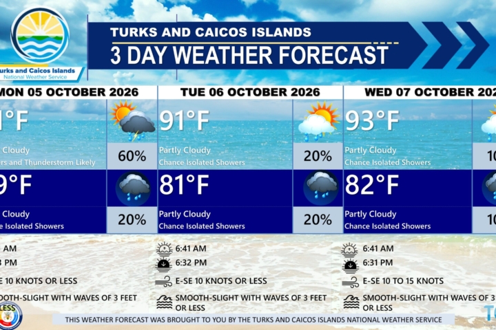
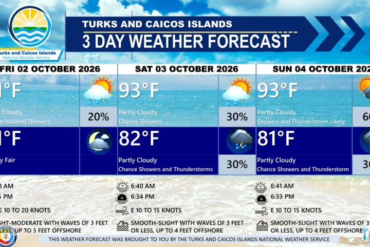
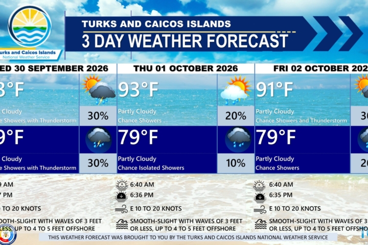
PUBLIC FORECAST FOR THE TURKS AND CAICOS ISLANDS FOR THE NEXT THREE DAYS FROM WEDNESDAY AUGUST 12TH 2026
GENERAL SITUATION: High pressure ridging will continue to maintain mostly stable conditions for the early part of the day, with shower chances increasing this afternoon as a tropical wave approaches the Turks and Caicos Islands.
SPECIAL WARNINGS:
A Heat Advisory remains in effect for the Turks and Caicos Islands. Residents and visitors should take the necessary precautions while outdoors during peak sunshine hours (10 am – 4 pm) and to safeguard their health as heat indices ranging from 100ºF to 105ºF are anticipated.
UV Index: The public is advised to wear protective clothing and sunscreen and seek shaded areas while outside during peak sunshine hours (10am – 4pm), as UV indices are expected to be in the very high to extreme range.
Saharan Dust: A plume of Saharan dust is producing milky/hazy skies across portions of the Turks and Caicos Islands today, which will filter out by this afternoon.
ALL AREAS
WEATHER: Partly cloudy and hazy with a low (10 percent) chance of isolated showers and possibly an isolated thunderstorm this afternoon. Partly cloudy with a low (10 to 20 percent) chance of showers and isolated thunderstorms tonight.
WINDS: Easterly at 5 to 15 knots
SEAS: Slight to moderate with wave heights of 3 feet or less nearshore, building up to 4 feet offshore
DAYTIME HIGH TEMPERATURE 91°F 32°C
HEAT INDEX 105°F 41°C
OVERNIGHT LOW TEMPERATURE 82°F 28°C
SUNSET: 07:21 PM
NEXT LOW TIDE: 02:39 PM (0.3 FT)
NEXT HIGH TIDE: 09:05 PM (3.0 FT)
EXTENDED FORECAST: The chance of shower and thunderstorm activity will persist across the Turks and Caicos Islands through Thursday as the tropical wave moves westward. Conditions will improve on Friday as high pressure builds across the area.
THURSDAY: A low (20 to 30 percent) chance of showers and isolated thunderstorms. Partly cloudy to cloudy, with a high near 90°F (32°C).
THURSDAY NIGHT: A low (10 to 20 percent) chance of showers and isolated thunderstorms. Partly cloudy, with a low around 82°F (28°C). New rainfall accumulation between a tenth to a quarter of an inch (2.5 to 6.5 mm).
WINDS: East to southeast at 10 to 20 knots, with higher gusts in the evening.
SEAS: Slight to moderate with wave heights of 3 feet or less nearshore, building up to 4 to 5 feet offshore
SUNRISE: 06:26 AM
SUNSET: 07:21 PM
LOW TIDE: 03:30 AM (0.7 FT) 03:33 PM (0.3 FT)
HIGH TIDE: 09:22 AM (2.6 FT) 09:52 PM (3.0 FT)
FRIDAY: Partly cloudy, with a high near 91°F (32°C).
FRIDAY NIGHT: Mostly fair, with a low around 82°F (28°C).
WINDS: East to southeast at 15 to 25 knots with higher gusts
SEAS: Slight to moderate with wave heights of 4 to 6 feet nearshore, building up to 7 to 8 feet offshore
SUNRISE: 06:26 AM
SUNSET: 07:20 PM
LOW TIDE: 04:14 AM (0.7 FT) 04:27 PM (0.7 FT)
HIGH TIDE: 10:13 AM (2.6 FT) 10:38 PM (3.0 FT)
TROPICAL WEATHER OUTLOOK:
1. Central Tropical Atlantic (AL92): An area of showers and thunderstorms associated with a tropical wave is located about 900 miles west-southwest of the Cabo Verde Islands. There is a high chance of formation through 48 hours and through 7 days. A tropical depression will likely form within a couple of days while the system moves westward to west-northwestward across the central tropical Atlantic.
2. Central Subtropical Atlantic (AL93): An area of low pressure is located about 1050 miles east-northeast of Bermuda. The system has a medium chance of formation through 48 hours and through 7 days. A short-lived tropical storm could form while it moves eastward to east-northeastward at around 20 mph across the central subtropical Atlantic.
3. Eastern Tropical Atlantic: A tropical wave just offshore of the coast of west Africa is producing disorganized showers and thunderstorms. This system has low chance of formation through 7 days while it moves westward or west-northwestward across the eastern and central tropical Atlantic.
FORECASTER: H. HAMILTON