GENERAL SITUATION: Divergent flow aloft combined with tropical moisture is producing clusters of showers and thunderstorms across the Turks and Caicos Islands and its surrounding waters today. A weak pressure gradient is keeping winds light to gentle across the islands.
SPECIAL WARNINGS: There are no public warnings in effect at this time.
ALL AREAS
WEATHER: Partly cloudy to cloudy with a low (10 to 30 percent) chance of showers with an isolated thunderstorm possible through tonight.
WINDS: East to southeast at 10 knots or less
SEAS: Smooth to slight with wave heights of 3 feet or less
DAYTIME HIGH TEMPERATURE 91°F 33°C
OVERNIGHT LOW TEMPERATURE 77°F 25°C
SUNSET: 06:46 PM
NEXT HIGH TIDE: 05:29 PM (2.6 FT)
NEXT LOW TIDE: 11:59 PM (1.3 FT)
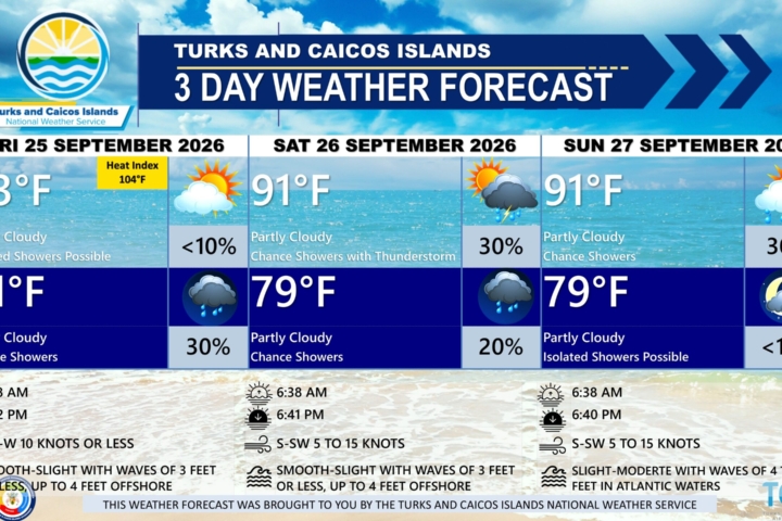
EXTENDED FORECAST: The risk of severe weather will ease, however, cloudy and wet conditions are expected to persist through midweek as abundant tropical moisture continues to stream across the Turks and Caicos Islands. Light to gentle winds with smooth to slight seas are expected through early Thursday.
TUESDAY: A low (10 to 20 percent) chance of showers with isolated thunderstorms possible. Partly cloudy to cloudy, with a high near 93°F (34°C).
TUESDAY NIGHT: A low (20 to 30 percent) chance of widely scattered showers. Partly cloudy, with a low around 77°F (25°C).
WINDS: East to southeast at 10 knots or less
SEAS: Smooth to slight with wave heights of 3 feet or less
SUNRISE: 06:37 AM
SUNSET: 06:45 PM
HIGH TIDE: 05:31 AM (2.0 FT) 06:12 PM (2.6 FT)
LOW TIDE: 11:32 AM (1.0 FT) – – – –
WEDNESDAY: A low (10 to 20 percent) chance of widely scattered showers. Partly cloudy, with a high near 93°F (34°C).
WEDNESDAY NIGHT: A low (10 to 20 percent) chance of widely scattered showers. Partly cloudy, with a low around 79°F (26°C).
WINDS: East to southeast at 10 knots or less
SEAS: Smooth to slight with wave heights of 3 feet or less
SUNRISE: 06:37 AM
SUNSET: 06:44 PM
LOW TIDE: 06:21 AM (2.0 FT) 06:54 PM (2.6 FT)
HIGH TIDE: 12:24 PM (1.0 FT) – – – –
TROPICAL WEATHER OUTLOOK:
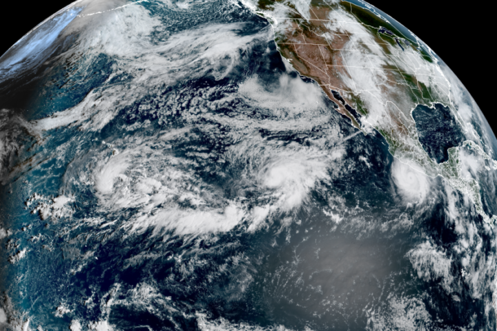
Active Systems: Tropical Storm Fay is located several hundred miles southwest of the Azores. Fay is moving very slowly toward the south near 5 mph. Maximum sustained winds have decreased to near 50 mph with higher gusts. Continued weakening is forecast, and Fay could degenerate to a post-tropical remnant low in a couple of days.
Tropical cyclone formation is not expected during the next 7 days.
FORECASTER: H. HAMILTON