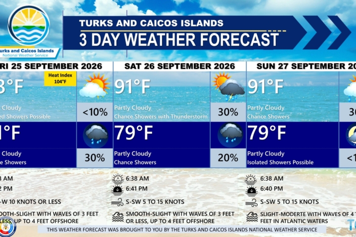
GENERAL SITUATION: A weak pressure gradient is maintaining light to gentle winds and smooth to slight seas across the Turks and Caicos Islands today.
SPECIAL WARNINGS: No public warnings in effect at this time.
ALL AREAS
WEATHER: Partly cloudy with a low (10 to 20 percent) chance of isolated showers with an isolated thunderstorm possible through tonight.
WINDS: East to southeast at 10 knots or less
SEAS: Smooth to slight with wave heights of 3 feet or less
DAYTIME HIGH TEMPERATURE 91°F 33°C
HEAT INDEX 104°F 39°C
OVERNIGHT LOW TEMPERATURE 82°F 28°C
SUNSET: 06:44 PM
NEXT LOW TIDE: 12:24 PM (1.0 FT)
NEXT HIGH TIDE: 06:54 PM (2.6 FT)
EXTENDED FORECAST: Light to gentle winds are expected to persist across the Turks and Caicos Islands through the end of the week. An approaching cold front is expected to near the islands by the weekend before weakening, with prefrontal showers and thunderstorms possible Friday night into the weekend.
THURSDAY: A low (10 percent) chance of isolated showers. Partly cloudy, with a high near 93°F (34°C).
THURSDAY NIGHT: A low (10 percent) chance of isolated showers. Partly cloudy, with a low around 82°F (28°C).
WINDS: East to southeast at 10 knots or less
SEAS: Smooth to slight with wave heights of 3 feet or less
SUNRISE: 06:38 AM
SUNSET: 06:43 PM
LOW TIDE: 01:14 AM (1.0 FT) 01:15 PM (0.7 FT)
HIGH TIDE: 07:09 AM (2.3 FT) 07:35 PM (2.6 FT)
FRIDAY: Isolated showers possible. Partly cloudy, with a high near 93°F (34°C).
FRIDAY NIGHT: A low (10 percent) chance of isolated showers with thunderstorms. Partly cloudy, with a low around 82°F (28°C).
WINDS: South to southwest at 10 knots or less
SEAS: Slight to moderate with wave heights of 3 feet or less, building up to 4 to 5 feet offshore
SUNRISE: 06:38 AM
SUNSET: 06:42 PM
LOW TIDE: 01:51 AM (1.0 FT) 02:04 PM (0.7 FT)
HIGH TIDE: 07:54 AM (2.6 FT) 08:15 PM (2.6 FT)
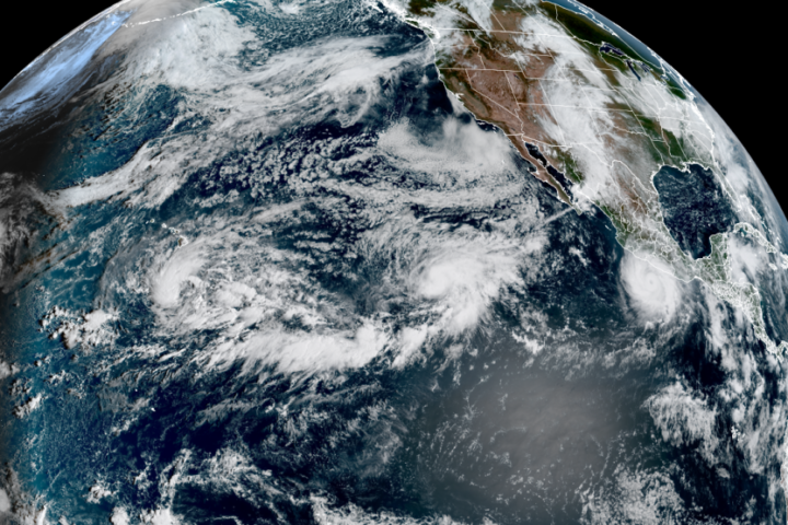
TROPICAL WEATHER OUTLOOK:
1. Far Eastern Tropical Atlantic: An area of low pressure, associated with a tropical wave that just moved off the west coast of Africa, has formed about 600 miles southeast of the Cabo Verde Islands. This system could become a short-lived tropical depression on Thursday or Friday while it moves northwestward to northward. However, strong upper-level winds should end the opportunity for development by the weekend. This system has a low chance of formation in the next 2 days and a medium chance of formation in the next 7 days.
2. Central Subtropical Atlantic (Former Tropical Storm Fay): A low-pressure system, formerly Tropical Storm Fay, is located about 800 miles southwest of the Azores. Significant re-development of this system is unlikely while it moves generally westward over the next couple of days. This system has a low chance of development in the next 7 days.
FORECASTER: H. HAMILTON