
GENERAL SITUATION: Fair and generally stable conditions are expected across the Turks and Caicos Islands today, however sea conditions will become hazardous as swells move into the area.
SPECIAL WARNINGS: A Small Craft Advisory is in effect for Atlantic waters. Small craft operators should remain near or in port until conditions improve.
Rip currents: There is a slight to moderate risk of rip currents across all Atlantic waters. Beachgoers and swimmers should exercise caution and refrain from entering the water.
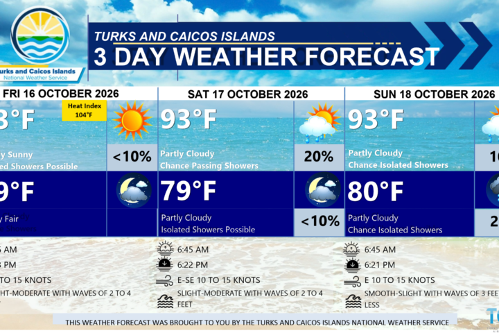
WEATHER: Partly cloudy with isolated showers possible through tonight.
WINDS: Easterly at 10 knots or less through this afternoon, becoming northeast to east at 10 to 15 knots during the evening hours
SEAS: Slight to moderate with wave heights of 2 to 4 feet nearshore, building up to 6 to 9 feet offshore in northerly swell by this evening
DAYTIME HIGH TEMPERATURE 91°F 33°C
HEAT INDEX 104°F 40°C
OVERNIGHT LOW TEMPERATURE 80°F 26°C
SUNSET: 06:21 PM
HIGH TIDE: 03:50 PM (2.3 FT)
NEXT LOW TIDE: 10:17 PM (1.3 FT)
EXTENDED FORECAST: Shower and thunderstorm chances will increase across portions of the Turks and Caicos Islands as a frontal boundary stalls nearby, before gradually dissipating late Wednesday into early Thursday. Hazardous sea conditions will persist due to long period swells — mariners and beachgoers should exercise caution.
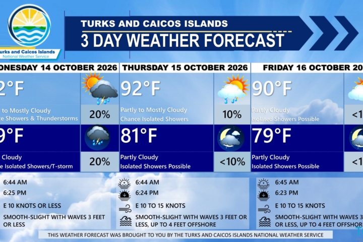
TUESDAY: Partly cloudy with a low (20 percent) chance of showers in the morning, then a medium (40 to 60 percent) chance of showers with isolated thunderstorms possible in the afternoon. Highs near 90°F (32°C).
TUESDAY NIGHT: Partly cloudy with a low (20 percent) chance of showers with isolated thunderstorm possible. Lows around 79°F (26°C).
WINDS: Easterly at 10 knots or less, falling light and variable at times
SEAS: Smooth to slight with wave heights of 3 feet or less in the Caicos Bank; Slight to moderate with wave heights of 2 to 4 feet nearshore, building up to 6 to 9 feet in northerly swells offshore in Atlantic waters.
SUNRISE: 06:46 AM
SUNSET: 06:20 PM
HIGH TIDE: 03:49 AM (2.0 FT) 04:38 PM (2.3 FT)
LOW TIDE: 09:52 AM (1.0 FT) 11:03 PM (1.0 FT)
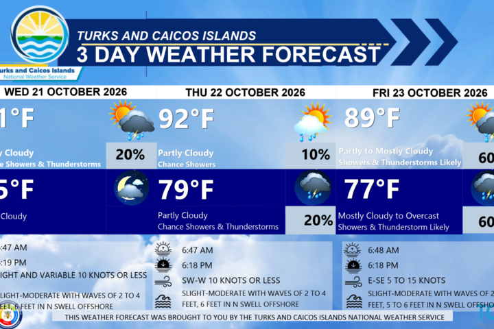
WEDNESDAY: Partly to mostly cloudy with a medium (40 to 60 percent) chance of showers with an isolated thunderstorm possible. Highs near 90°F (32°C).
WEDNESDAY NIGHT: Partly cloudy with a low (20 to 30 percent) chance of showers. Lows around 79°F (26°C).
WINDS: South to southwest at 10 knots or less, falling light and variable at times
SEAS: Smooth to slight with wave heights of 3 feet or less in the Caicos Bank; Slight to moderate with wave heights of 2 to 4 feet nearshore, building up to 6 feet in northerly swells offshore in Atlantic waters.
SUNRISE: 06:47 AM
SUNSET: 06:19 PM
HIGH TIDE: 04:49 AM (2.0 FT) 05:26 PM (2.3 FT)
LOW TIDE: 10:54 AM (1.0 FT) 11:46 PM (1.0 FT)
TROPICAL WEATHER OUTLOOK:
1. A storm-force non-tropical low pressure area is located along a frontal boundary a few hundred miles off the southeast coast of the United States. This low is likely to move slowly and erratically over the next couple of days, and it could gradually acquire subtropical characteristics if it remains over the Gulf Stream. This system has a medium chance of tropical formation over the next 7 days.
FORECASTER: H. HAMILTON