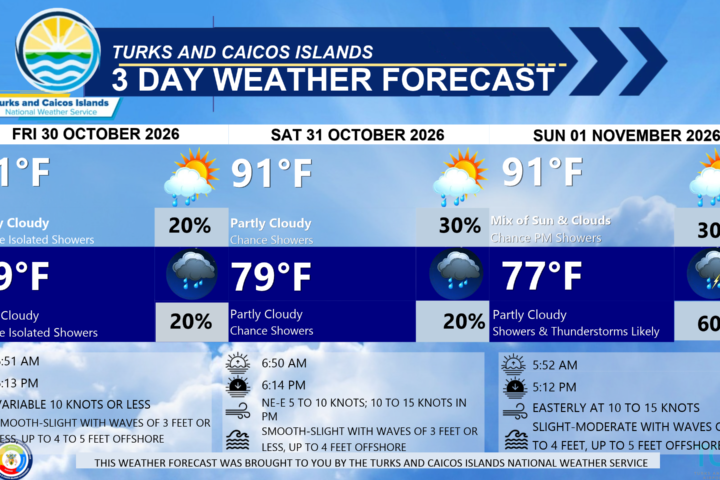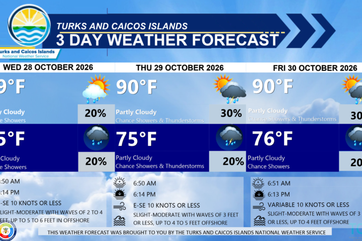

GENERAL SITUATION: A trough linked to a weakening front, along with increasing moisture and a mid- to upper-level trough to the west, will maintain periods of cloudiness and unsettled conditions across much of the Turks and Caicos Islands today.
SPECIAL WARNINGS: There are no public warnings or advisories in effect at this time.
Rip Currents: There is a moderate risk of rip currents along Atlantic-facing coastlines. Beachgoers are urged to exercise extreme caution.
ALL AREAS
WEATHER: Partly cloudy with a medium (40 percent) chance of scattered showers and isolated thunderstorms through tonight.
WINDS: Easterly at 10 to 15 knots, falling light and variable at times.
SEAS: Slight to moderate with wave heights of 2 to 4 feet, building up to 5 to 6 feet offshore
DAYTIME HIGH TEMPERATURE 90°F 32°C
OVERNIGHT LOW TEMPERATURE 77°F 25°C
SUNSET: 05:11 PM
NEXT HIGH TIDE: 02:19 PM (2.6 FT)
NEXT LOW TIDE: 08:53 PM (1.0 FT)
EXTENDED FORECAST: Abundant moisture and upper-level support will increase the chance of showers and thunderstorm activity across the Turks and Caicos Islands over the next couple of days.
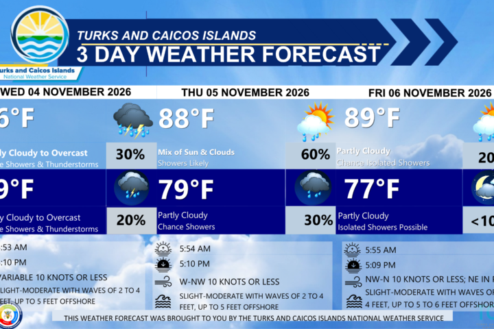
TUESDAY: Partly to mostly cloudy with a medium (40 percent) chance of scattered showers and isolated thunderstorms. Highs near 88°F (31°C).
TUESDAY NIGHT: Partly cloudy with a medium (40 percent) chance of scattered showers and isolated thunderstorms. Lows around 79°F (26°C).
WINDS: East to southeast at 10 knots or less
SEAS: Slight to moderate with wave heights of 2 to 4 feet, building up to 5 feet offshore
SUNRISE: 05:53 AM
SUNSET: 05:11 PM
HIGH TIDE: 02:37 AM (2.3 FT) 03:20 PM (2.6 FT)
LOW TIDE: 08:50 AM (0.7 FT) 09:51 PM (1.0 FT)
WEDNESDAY: Partly cloudy with a low (10 to 20 percent) chance of showers with isolated thunderstorms. Highs near 89°F (32°C).
WEDNESDAY NIGHT: Partly cloudy with a low (10 to 20 percent) chance of showers with isolated thunderstorms. Lows around 79°F (26°C).
WINDS: Variable at 10 knots or less
SEAS: Smooth to slight with wave heights of 3 feet or less, building up to 4 feet offshore
SUNRISE: 05:53 AM
SUNSET: 05:10 PM
HIGH TIDE: 03:48 AM (2.3 FT) 04:20 PM (2.6 FT)
LOW TIDE: 10:03 AM (0.7 FT) 10:45 PM (0.7 FT)
TROPICAL WEATHER OUTLOOK:
1. Western Atlantic: An area of low pressure is likely to form along a weakening frontal boundary a few hundred miles northeast of the Bahamas in a couple of days. This system could acquire some subtropical characteristics late this week while it drifts over the western Atlantic. The chances of subtropical development should end by the weekend when the system is expected to move eastward or northeastward into unfavorable environmental conditions. This system has a low chance of formation over the next 7 days.
FORECASTER: H. HAMILTON