
GENERAL SITUATION: Drier air is moving into the Turks and Caicos Islands today, bringing more stable conditions as a low-pressure system to the east draws moisture away from the region.
SPECIAL WARNINGS: None.
Rip Currents: There is a slight to moderate risk of rip currents along all Atlantic coastal waters of the island chain. Beachgoers are urged to exercise caution.
ALL AREAS
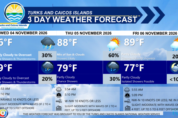
WEATHER: Partly cloudy with isolated showers possible, then a low (10 to 20 percent) chance of isolated passing showers tonight.
WINDS: Northwest to north at 10 knots or less
SEAS: Smooth to slight with wave heights of 3 feet or less in the Caicos Bank; Slight to moderate with wave heights of 2 to 4 feet nearshore, building up to 5 to 6 feet offshore in Atlantic waters.
DAYTIME HIGH TEMPERATURE 88°F 31°C
OVERNIGHT LOW TEMPERATURE 77°F 25°C
SUNSET: 05:09 PM
NEXT LOW TIDE: 12:13 PM (0.7 FT)
NEXT HIGH TIDE: 06:09 PM (2.6 FT)
EXTENDED FORECAST: Mostly dry, stable, and warm conditions are expected to persist through the weekend and into midweek, with a few isolated passing showers possible. Weak high pressure will then build across the Turks and Caicos Islands, bringing generally light to gentle breezes.
SATURDAY: Partly cloudy with a low (10 to 20 percent) chance of isolated showers. Highs near 88°F (31°C)
SATURDAY NIGHT: Mostly fair with isolated showers possible. Lows around 75°F (24°C).
WINDS: Northerly at 10 knots or less
SEAS: Smooth to slight with wave heights of 3 feet or less in the Caicos Bank; Slight to moderate with wave heights of 2 to 4 feet nearshore, building up to 5 to 6 feet offshore in Atlantic waters.
SUNRISE: 05:55 AM
SUNSET: 05:09 PM
LOW TIDE: 12:21 AM (0.7 FT) 01:08 PM (0.7 FT)
HIGH TIDE: 06:42 AM (3.0 FT) 06:59 PM (2.3 FT)
SUNDAY: Mostly sunny with isolated showers possible. Highs near 88°F (31°C).
SUNDAY NIGHT: Fair with isolated showers possible. Lows around 73°F (23°C).
WINDS: North to northeast at 10 knots or less, falling light and variable at times, then shifting easterly at night.
SEAS: Smooth to slight with wave heights of 3 feet or less in the Caicos Bank; Slight to moderate with wave heights of 2 to 4 feet nearshore, building up to 5 to 6 feet offshore in Atlantic waters.
SUNRISE: 05:56 AM
SUNSET: 05:08 PM
LOW TIDE: 01:06 AM (0.7 FT) 01:58 PM (0.7 FT)
HIGH TIDE: 07:31 AM (3.0 FT) 07:45 PM (2.3 FT)
TROPICAL WEATHER OUTLOOK:
Western and Central Atlantic (AL94): A gale-force, non-tropical low pressure area located several hundred miles south of Bermuda is producing an area of cloudiness and showers. This system could briefly acquire some subtropical characteristics during the next couple of days while it moves generally eastward over the western and central subtropical Atlantic. This system has a low chance of formation over the next seven (7) days.
FORECASTER: H. HAMILTON