This is an update from The Department of Disaster Management and Emergencies as at September 24, 2025 at 12:00 pm
The tropical wave, designated Invest 94L, is expected to move west-northwestward at 15 to 20 mph, into the southwestern Atlantic and near the Turks and Caicos Islands by late Thursday.
The system has a low (30%) chance of formation within the next 48 hours and a high (80%) chance within the next 7 days.
Latest model guidance indicate that Invest 94L will likely impact the Turks and Caicos Islands as a strong tropical wave. However, there remains the potential for development into a tropical depression or tropical storm in the vicinity of the Turks and Caicos Islands or the southeastern/central Bahamas.
What to Expect
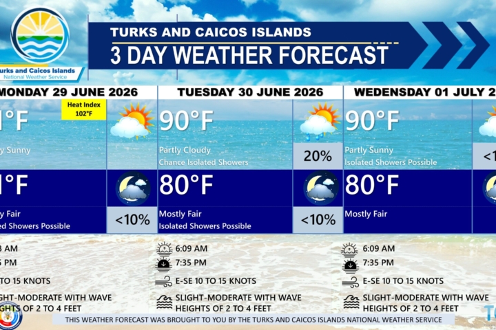
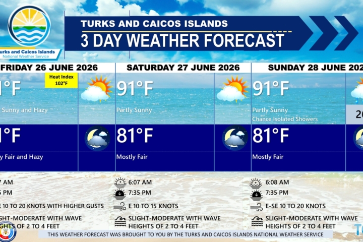
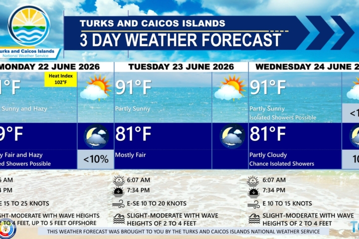
The Turks and Caicos Islands should expect a few days of unsettled weather (i.e., periods of showers and thunderstorm activity, rough seas) beginning Thursday evening and continuing into the weekend.
HAZARDS DETAILS RISK AREAS
Winds 10-12 knots All Islands
Rainfall/Flooding 2-4 Inches All Islands
Storm Surge N/A N/A
Seas 5-8 feet Atlantic Exposures

There are no watches, warnings or advisories at this time.
The TCI Meteorology Department will continue to monitor and provide updates.
Prepare for possible adverse weather conditions later this week and plan accordingly.
Continue making Hurricane preparations. We are still in the peak of the Hurricane season.
Follow The TCI National Weather Service and DDME to stay updated